Dundalk’s industrial growth from a medieval port to a modern logistics hub has left a layered subsurface that still surprises even experienced crews. The town sits on low-lying ground where glacial tills, soft alluvial silts and occasional peat pockets alternate within short distances, a legacy of the Castletown River’s shifting course and post-glacial deposition. When you open a deep excavation for a basement, a storm tank or a new warehouse foundation along the Inner Relief Road, monitoring is not a checkbox exercise. Our team places a strong emphasis on tracking pore-water pressure dissipation, lateral deformation and vibration thresholds because the transition from stiff till to soft silt can happen in less than two metres. Before breaking ground we often pair the monitoring plan with a site-specific CPT profile to map the exact depth of the compressible layer that will control wall deflection and base heave. That early correlation between cone resistance and future inclinometer readings saves time when the shoring is already in place and the clock is ticking.
In Dundalk’s layered glacial deposits, the difference between a stable cut and a creeping failure is often a 40 cm silt lens nobody logged during the site investigation.
Service characteristics in Dundalk
Critical ground factors in Dundalk
One thing we see repeatedly in Dundalk is that temporary works designers underestimate the relaxation time of the glacial till. They assume it will stand unsupported for a few days, but a sudden shower combined with a lens of laminated silt can trigger a shallow slip that takes out the crest. The real danger is not the big collapse you see coming, it is the small movement that damages an adjacent 19th-century masonry building before anyone notices the crack. For that reason we always place crack monitors on structures within a distance equal to twice the excavation depth, and we set an amber threshold at 5 mm of cumulative movement. If the piezometers show pore pressures not dissipating as quickly as the dewatering plan assumed, we call for a review before the next lift. In a town where the water table often sits less than two metres below ground level, managing hydrostatic pressure is half the monitoring battle. The other half is making sure the data reaches the right person before the morning site meeting, not after.
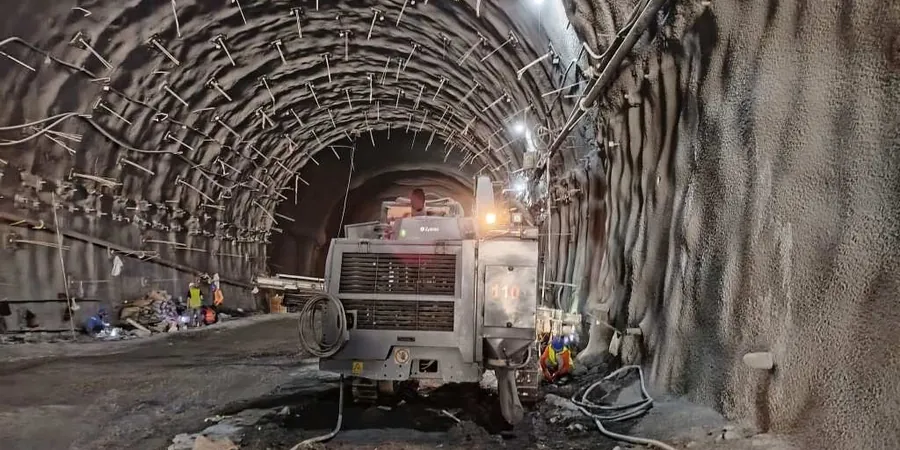
Our services
Our Dundalk monitoring packages are built around the specific excavation method, the sensitivity of nearby structures and the groundwater regime encountered during the initial boreholes.
Deep Excavation Monitoring for Urban Basements
Full instrumentation array with inclinometers, piezometers and automated total station tracking for basements and service trenches in the town centre. Includes daily interpretation of deformation profiles against the design envelope and pre-condition surveys of neighbouring properties.
Cut-and-Cover and Utility Trench Monitoring
Lightweight monitoring scheme for linear excavations along road corridors and industrial estates. Vibration monitoring with triaxial geophones is added when sheet piling or dynamic compaction occurs within 30 m of sensitive structures.
Frequently asked questions
What is the typical cost range for excavation monitoring on a Dundalk commercial project?
For a standard commercial excavation in the Dundalk area, monitoring packages generally fall between €780 and €2.450 depending on the number of instruments, the duration of readings and the reporting frequency required. A small utility trench with a few surface markers sits at the lower end, while a deep basement with multiple inclinometers, piezometers and daily interpreted reports moves toward the upper end.
How quickly can you install instrumentation once the excavation starts?
We aim to have inclinometer casings and piezometers grouted at least one week before the first cut, so the baseline readings are stable. Surface markers and crack monitors can be installed in a single day if the control network is already established.
Which alarm thresholds do you apply for Dundalk's soil conditions?
Thresholds are set per project based on the design deformation limits, but as a rule of thumb we use an amber alert at 80% of the predicted lateral movement and a red alert if the rate of deformation exceeds 2 mm/day over two consecutive readings. For structures on shallow foundations we often lower the amber limit to 5 mm cumulative.
Do you provide the monitoring data in formats compatible with BIM or project management platforms?
Yes, all our data can be exported as CSV or integrated via API into common CDE platforms. Daily reports include graphs of deformation versus time, pore pressure evolution and a summary table with current status against each trigger level.